Google is the most popular search engine, but the company has done more things besides make browsing easy. It offers an array of services and products that make life a bit more exciting and convenient.
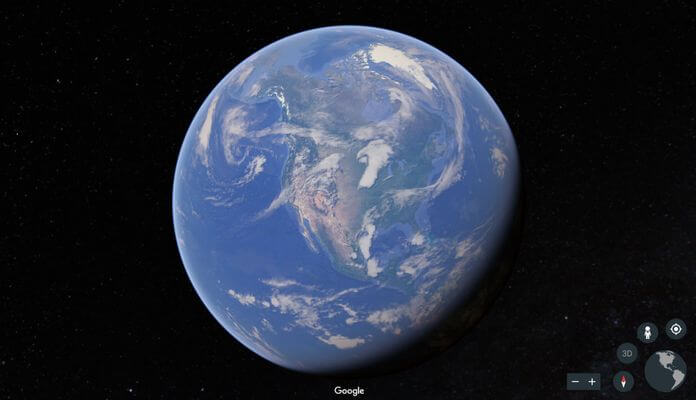
The company came up with Google Earth, which is a geobrowser that lets you explore destinations all around the world from the comfort of your home.
The tool was launched more than 15 years ago, so it’s not a completely new thing. However, Google has released updates on it constantly and added more features for people to enjoy. If you’ve not tried it yet, you’re really missing out.
Of course, before you download the app, there’s something you should decide on now – which version of Google Earth will you use – the regular version or the pro one? What’s the difference between them?
Google Earth Pro was once a version you had to pay for, but Google opted to make it free like its regular version. However, the Pro version has some very advanced features that you don’t see with Google Earth. Before you decide on which one to go with, it’s important to know how they’re like each and how they’re unlike.
A Look At Google Earth
If you want to explore the World, Google Earth’s basic features will do just nicely. You’ll see 3D images that were taken from outer space and be able to zoom in on the detailed photos. With the latest version, you get the Voyager tool. This tool allows you to watch live stream broadcasts of areas around the world including habitats of various species. The tool also lets you view various places and clips while taking a guided tour of the location.
Google Earth includes many other features like the Knowledge Cards – pop-ups about the location you are watching. According to Google, users will soon be able to share their pictures and become a part of the map.
With its basic features, you can look at images of past outer space explorations, view NASA satellite images and get 3D metaphors of the ocean floors, which includes shipwrecks.
A Look At Google Earth Pro
Google Earth Pro has all the basic features Google Earth has and more. Why? It was developed for businesses, enabling them to use it for presentations and research. Users can develop various types of media via Movie Maker. They can print hi-resolution location images and screenshots and map GIS information so vector image files can be imported.
Google Earth include distance measurement tools, but the Pro version offers more. It can measure both straight lines and areas – something necessary in attaining geographical information.
There’s no doubt how advanced Google Earth Pro is, but which one you use is depending on what you’re going for. Whatever you decide, they’re both free!